Stand on a ridge and look around: some terrain is visible, some is hidden behind other terrain. A viewshed is that picture computed in advance — a map layer showing, for any point you choose, exactly which ground can be seen from it and which can't. You get the ridge-top view without climbing the ridge, for any spot on Earth.
How it works
The input is a digital elevation model (DEM) — a grid of ground heights, typically one value every 30 or 90 meters, built from satellite radar missions like SRTM. From your chosen observer point, the algorithm casts rays outward in every direction. Along each ray it walks the terrain, tracking the steepest sight line so far: cells the line clears are marked visible, cells tucked behind a rise are hidden. Repeat for thousands of rays and the result paints every cell around you as seen or unseen.
Two refinements matter more than people expect:
- Observer and target height. Eyes are ~1.7 m above ground; a radio mast might be 10 m. Raising either end changes the result significantly — a good tool lets you set both.
- Earth curvature and refraction. Beyond a few kilometers the planet's curve starts hiding low ground, while the atmosphere bends light slightly downward and gives a little back. Long-range analysis that ignores this is wrong at the edges.
Viewshed, line of sight, terrain profile — three tools, one idea
- Viewshed: one point → visibility of everything around it. "What can I see from here?"
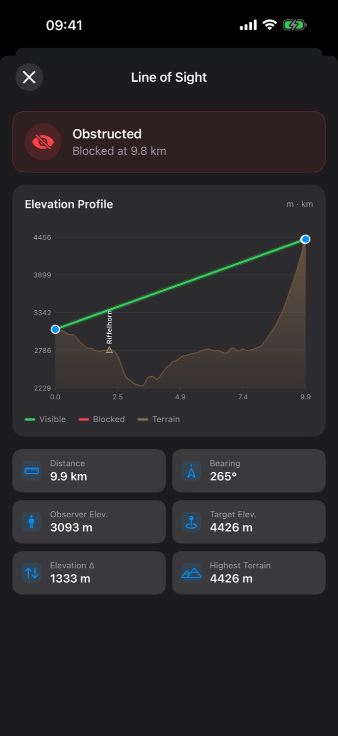
- Line of sight (LOS): two points → a yes/no answer with the blocking terrain identified. "Can the OP see the trailhead?"
- Terrain profile: the elevation cross-section along that line — where the ridges and dead ground actually are.
What people actually use it for
- Hunting. Pick your glassing point the evening before: run a viewshed from the saddle and know whether the basin below is actually visible or hidden behind a shoulder you can't judge from the topo lines.
- Radio & antenna planning. VHF/UHF is line-of-sight; a viewshed from a proposed repeater site is its coverage sketch. Ham operators choosing a summit, event teams placing a relay, off-grid links between properties — same math.
- Observation posts & field exercises. The classic military use: does this position overwatch the route, and what dead ground can approach unseen? Works in reverse too — where can you move without being observed?
- Search and rescue. From a lookout point, which slopes can spotters actually clear, and which gullies need a ground team?
- Choosing a campsite, cabin site, or photo spot. Sometimes you just want to know if the sunrise clears the opposite ridge.
What a viewshed can't tell you
The elevation model is bare earth at ~30 m resolution. Forests, buildings and hedgerows mostly aren't in it — terrain-visible ground can still hide behind trees. Treat visible cells as "terrain permits a sight line," not a guarantee, and treat the edges of the visible area as fuzzy, not sharp. For decisions that matter, the viewshed narrows your options; your eyes make the final call.
Running one on your iPhone
This used to require desktop GIS software and a DEM download. Both of my apps do it on the phone, offline-capable, in a couple of taps — pick the one that matches how you work:

Terrain Profile & LOS — the dedicated tool
Viewshed from any point (free up to a 5 km radius, up to 30 km with premium), line of sight between points up to 500 km, exportable elevation profiles and optional 30 m high-resolution terrain data. If visibility analysis is the job, start here.
Get Terrain Profile & LOS →
Tactical GPS — viewshed inside a full land-nav kit
The same viewshed and LOS analysis built into a complete MGRS navigation app: offline topo maps, grid overlay, NATO symbols, TAK connectivity. If you're planning routes and marking positions anyway, run the analysis where your map already is.
Get Tactical GPS →