
Land navigation,
built like an instrument.
Precision MGRS & UTM navigation for iPhone. Offline topographic maps, terrain analysis and TAK connectivity — everything you need to plan, navigate and operate in the field, nothing you don't.
App Store FREE DOWNLOAD · PRO UNLOCK IN-APP
capabilities
A complete land-nav toolkit in one app — no account, no cloud dependency, no clutter.
MGRS & UTM native
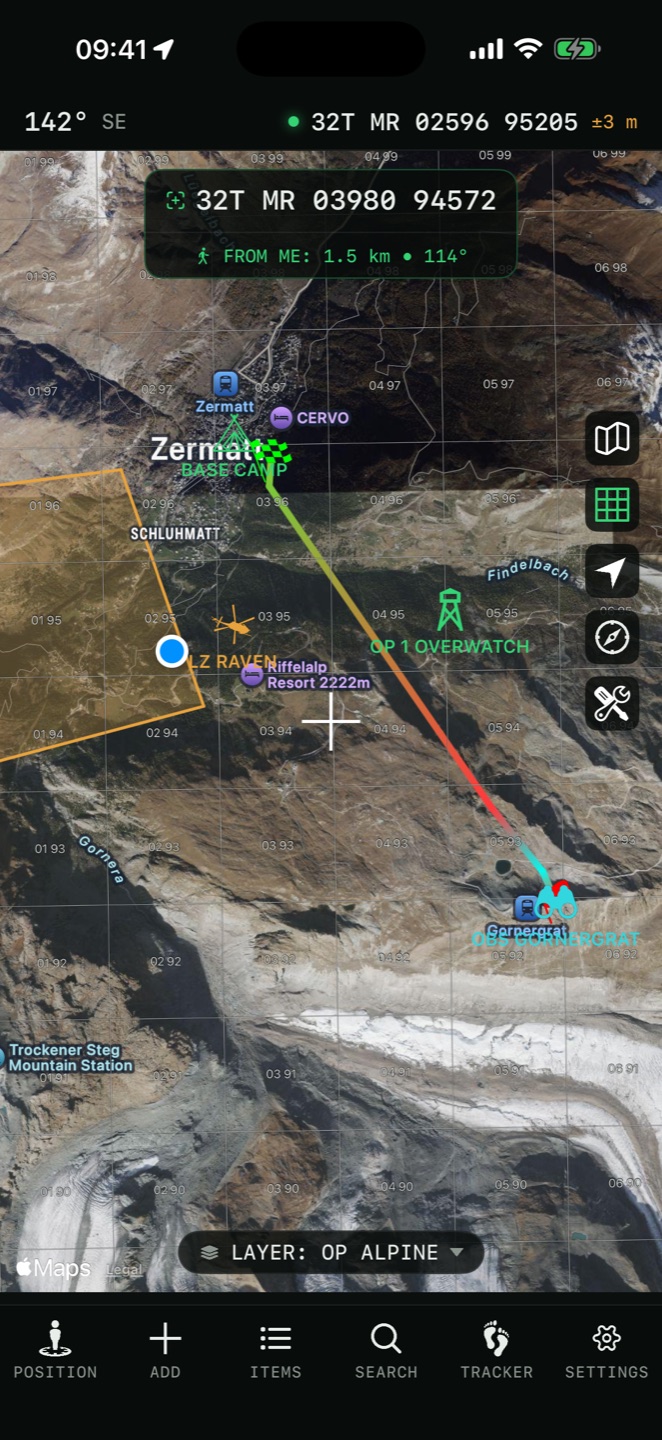
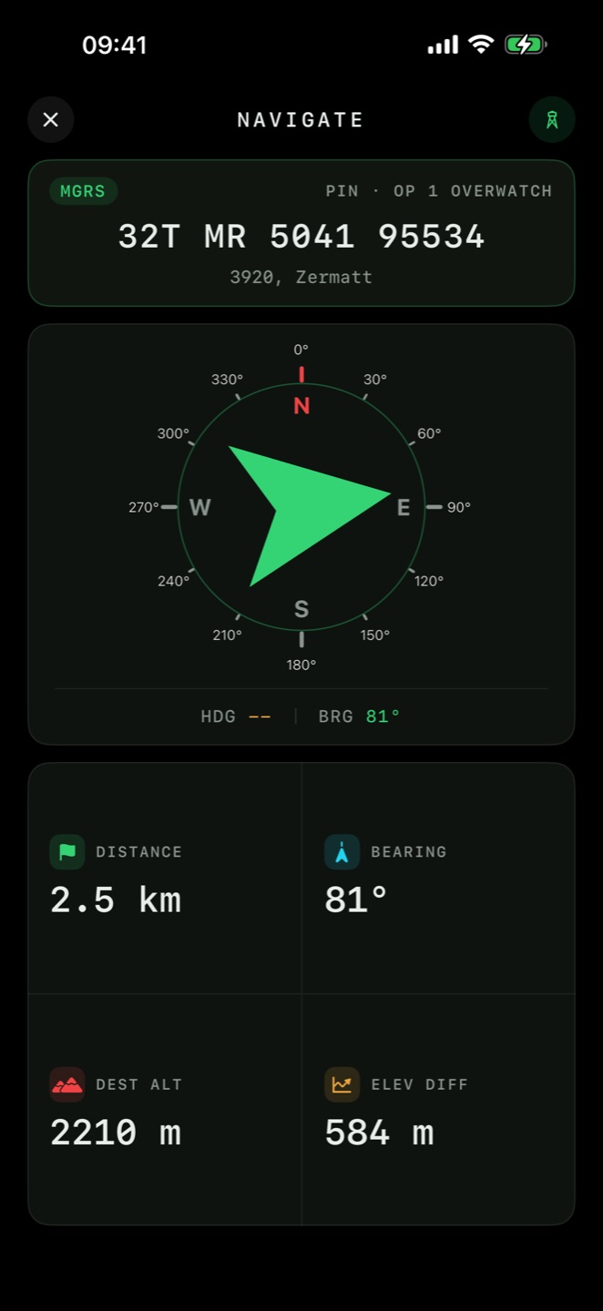
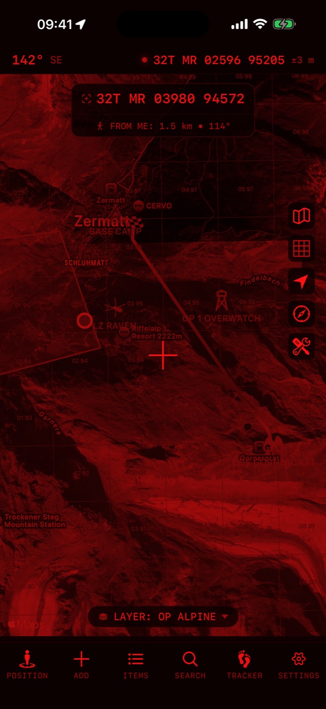
Full-precision military grid with live grid overlay, coordinate conversion and pin plotting the way trained navigators expect.
Offline topo maps
Download topographic and satellite layers for entire regions. Navigate with zero signal — airplane mode is the test.
Viewshed & line of sight
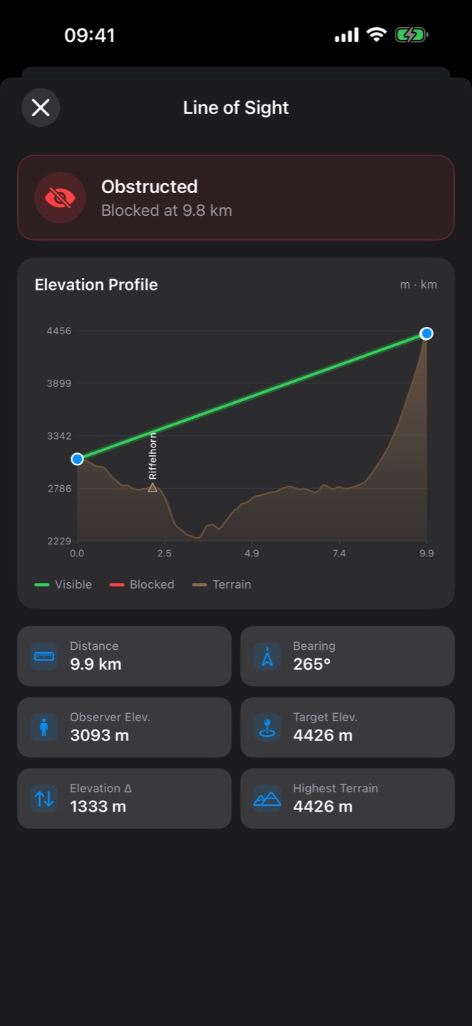
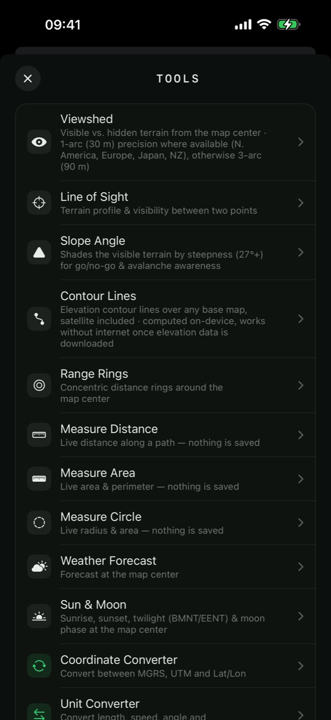
See exactly what's visible from any point, or check LOS between two positions with a full elevation profile.
TAK connectivity
Connect to TAK servers with built-in certificate enrollment — share your position and see your team's, straight from the app.
NATO APP-6 symbols
Mark friendly, hostile, neutral and unknown units with standard military symbology instead of generic pins.
Night-vision mode
Red or green monochrome display across the entire app preserves your dark adaptation on night ops.
External GNSS / RTK
Pair Bluetooth GNSS receivers for centimeter-class RTK positioning when phone GPS isn't enough.
GPX · KML · GeoPackage
Import and export routes, tracks and overlays. Bring mission data in, take your recon out.
Routes, rings & sensors
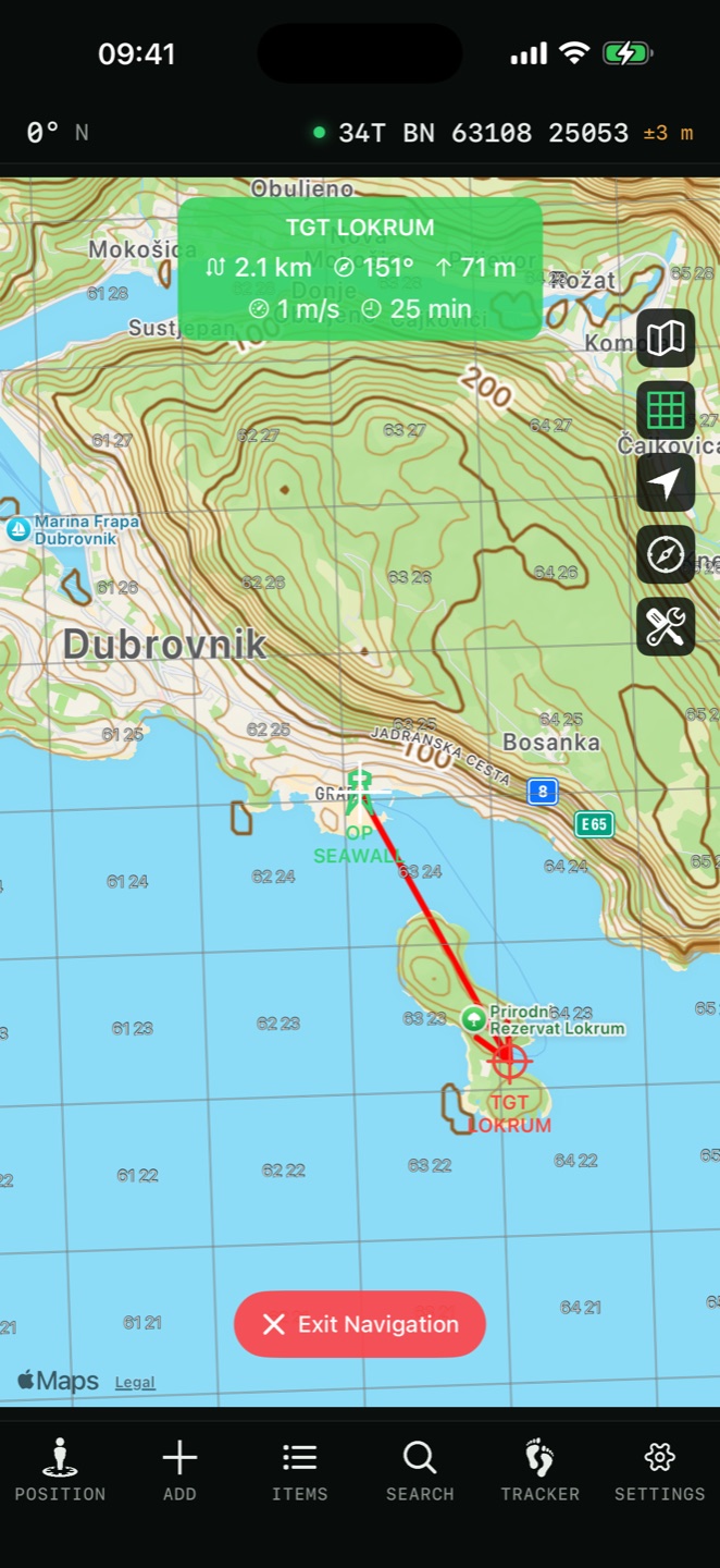
Route planning with elevation profiles, range rings, geofences, tactical compass, tracker and weather.
built for
One instrument, four missions.
Land nav training
Practice plotting MGRS points, pace counts and terrain association before your course — or keep the skill sharp after it.
TAK teams
A lightweight iOS TAK client for volunteer SAR, event safety and coordinated field teams.
Backcountry & hunting
Scout glassing points with viewshed, plan routes offline and navigate far beyond cell coverage.
Milsim & airsoft
Plan operations with NATO symbology, range rings and shared overlays that look the part — because they are.
field views
Actual screens. The dark, glare-free UI is the default — not a theme.
faq
Straight answers to the questions we get most.
What is MGRS and why use it instead of latitude/longitude?
Does the app work offline?
Can it connect to a TAK server? Is it an iTAK alternative?
What is viewshed analysis?
Does it support external GPS receivers?
Can I import my own map data?
What's free and what's Pro?
Which devices does it run on?
deploy
Free to download. Core navigation included; Pro unlocks the full toolkit — one-time Lifetime option available.
App Store REQUIRES iOS 16+ · iPHONE & iPAD