Field manual · 02/12
Map & Layers
Pick the right base map for the job, overlay it with a full-precision MGRS grid, and take all of it offline.
map types

Built-in maps
Apple Maps, Google Maps (Standard, Satellite, Hybrid), OpenTopoMap, USGS Topo and USGS Imagery.

Trail overlays
Hiking trails, ski trails, cycling trails and sea marks layers for specialized terrain.

Offline vector maps
An OpenFreeMap-based vector map designed for fully offline use — download regions in advance.

Custom sources PRO
Add your own XYZ/TMS tile server URL, or use map tiles imported from a GeoPackage file.
mgrs grid

Grid overlay
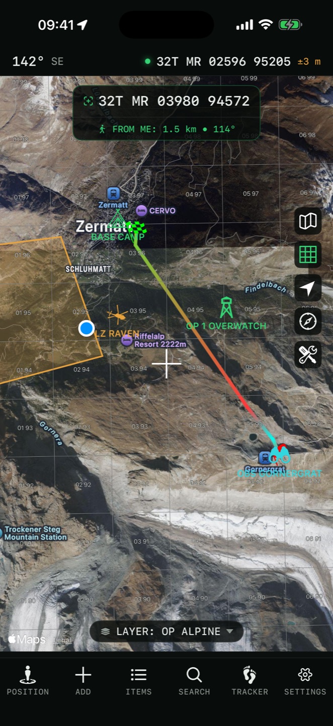
Toggle the MGRS grid from the map controls. The overlay draws grid-zone, 100 km and fine grid lines with labels, at a density that follows your zoom level.

Grid appearance
In Settings → MGRS Grid you can set grid density and choose separate colors for zone, 100 km and fine lines, plus overall grid opacity.
offline use
Two mechanisms keep you navigating without signal:
All coordinate conversion, navigation and terrain tools run on-device — airplane mode is the test.
layers

Organize with layers PRO
Group pins and overlays into layers — one per mission, training area or trip. Tap the layer name at the bottom of the map to switch. Each layer can be exported and shared as a file.