
Field manual · 17/17
Free vs Pro
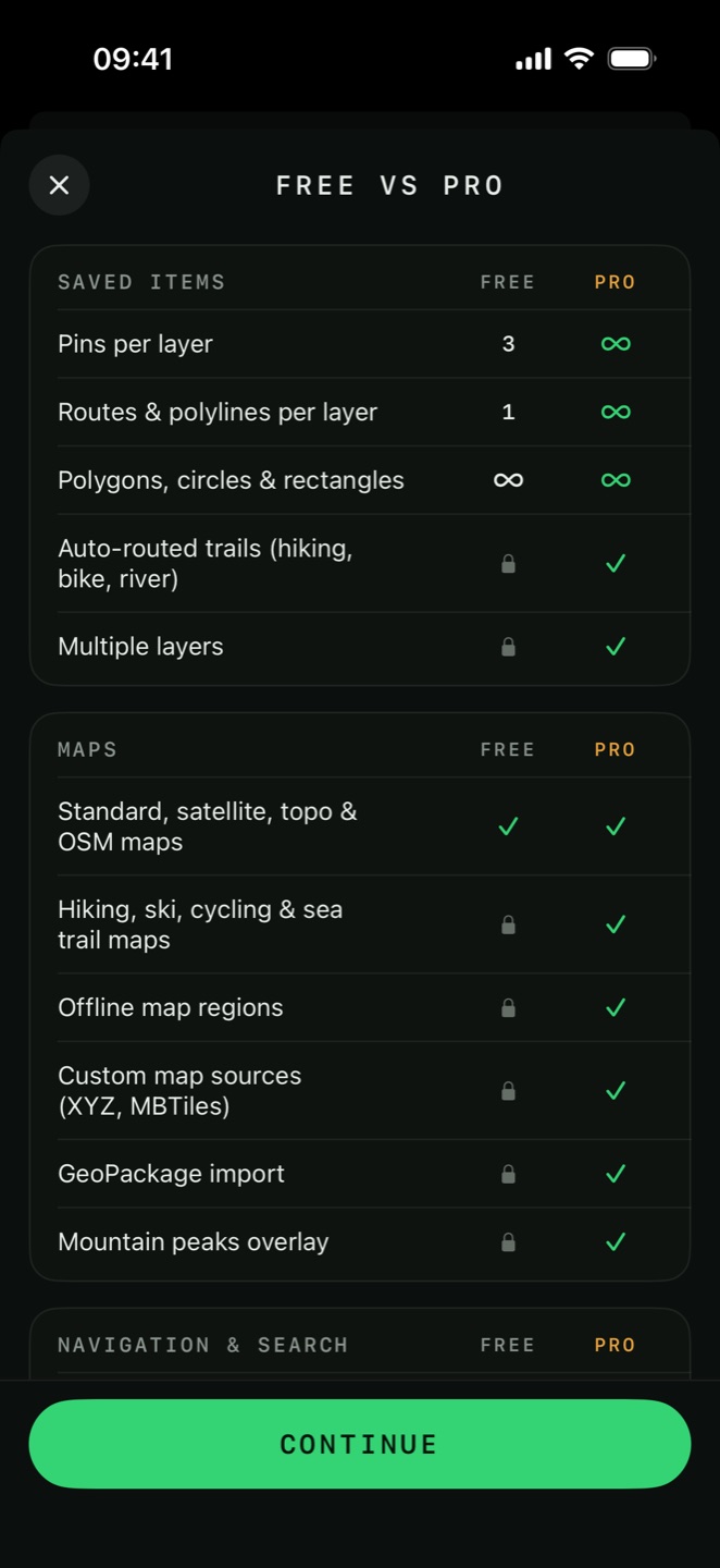
Tactical GPS is free to install and free to navigate with. Pro is a one-time purchase that lifts the limits and unlocks the analysis, recording and data tools. This is the same comparison the app shows on its own paywall, row for row.
how pro works
Pro is a single non-consumable purchase, not a subscription. Buy it once and it stays on your Apple ID: reinstall the app, move to a new iPhone or restore a backup and it comes back. There is no account to create and nothing to renew.

Restore Purchase
If Pro doesn't come back on its own after a reinstall, open Settings → Info → Upgrade to Pro and tap Restore Purchase. The App Store re-issues the entitlement.
the comparison
| Feature | Free | Pro |
|---|---|---|
| Saved items | ||
| Pins per layer | 3 | ∞ |
| Routes & polylines per layer | 1 | ∞ |
| Polygons, circles & rectangles | ∞ | ∞ |
| Auto-routed trails (hiking, bike, river) | 1 | ✓ |
| Multiple layers | — | ✓ |
| Maps | ||
| Standard, satellite, topo & OSM maps | ✓ | ✓ |
| Hiking, ski, cycling & sea trail maps | — | ✓ |
| Offline map regions | — | ✓ |
| Custom map sources (XYZ, MBTiles) | — | ✓ |
| GeoPackage import | — | ✓ |
| Mountain peaks overlay | — | ✓ |
| Navigation & search | ||
| Compass & direct-line navigation | ✓ | ✓ |
| Car & walking routes | — | ✓ |
| Map-based route navigation | — | ✓ |
| Waypoint stepping & auto-advance | — | ✓ |
| Coordinate & MGRS search | ✓ | ✓ |
| Address search | — | ✓ |
| Terrain tools | ||
| AR View (camera overlay for peaks & pins) | 1 free | ✓ |
| Viewshed radius | 5 km | 20 km |
| Line of sight (verdict & metrics) | ✓ | ✓ |
| Line-of-sight elevation chart | — | ✓ |
| Slope angle shading | — | ✓ |
| Contour lines | — | ✓ |
| Spot elevation | — | ✓ |
| Sea depth (bathymetry) | — | ✓ |
| Range rings, distance & area measure | ✓ | ✓ |
| Route elevation profile | ✓ | ✓ |
| Recording & team | ||
| GPS track recording & sessions | Demo | ✓ |
| Backtrack (compass) | ✓ | ✓ |
| Backtrack (map-based) | — | ✓ |
| TAK server session length | 5 min | ∞ |
| Data & weather | ||
| Import KML, GPX & GeoJSON | ✓ | ✓ |
| Import CSV, Shapefile, IGC, Ozi & LOC | — | ✓ |
| Layer export & share | — | ✓ |
| Route export as GPX | — | ✓ |
| Weather forecast | Today | 10 days |
| Customization | ||
| Basic pin icons & NATO APP-6 symbols | ✓ | ✓ |
| Full pin icon library | — | ✓ |
| Custom pin & overlay colors | — | ✓ |
also part of pro
The table above is the app's own summary and predates a few features. These are Pro as well:
| Feature | Chapter |
|---|---|
Backup & restore (.tgpsbackup) | Import, Export & Backup |
| iCloud layer sharing with a team | Layers & iCloud Sharing |
| NTRIP correction streams (RTK) | External GNSS & RTK |
| Print Map as a true-scale PDF | Field Tools |
| Position averaging | Field Tools |
| Saving a measurement as an item | Field Tools |
| Elevation & depth points | Pins & Shapes |
| Custom pin icons from your own images | Pins & Shapes |
| Any EPSG projected coordinate system | Coordinates & Position |
| NTv2 & OSTN15 precision datum grids | Coordinates & Position |
| AR navigation to a pin | Navigation & Directions |
| Import DXF, GeoPackage, GeoTIFF, GeoPDF & AlpineQuest | Import, Export & Backup |
| Export KMZ, CSV, DXF, Shapefile & GeoPackage | Import, Export & Backup |
| Map presets | Maps & Overlays |
| Mapbox 3D maps (online) | Maps & Overlays |
| Image overlays & KML ground overlays | Maps & Overlays |
| Erase a colour from a raster layer | Maps & Overlays |
| Track folders & on-map playback | Tracker |
what the free version does well
The free tier is a complete land-navigation instrument, not a demo. Everything below works with no purchase and, once the map tiles are cached, with no signal: