
Field manual · 01/12
Getting Started
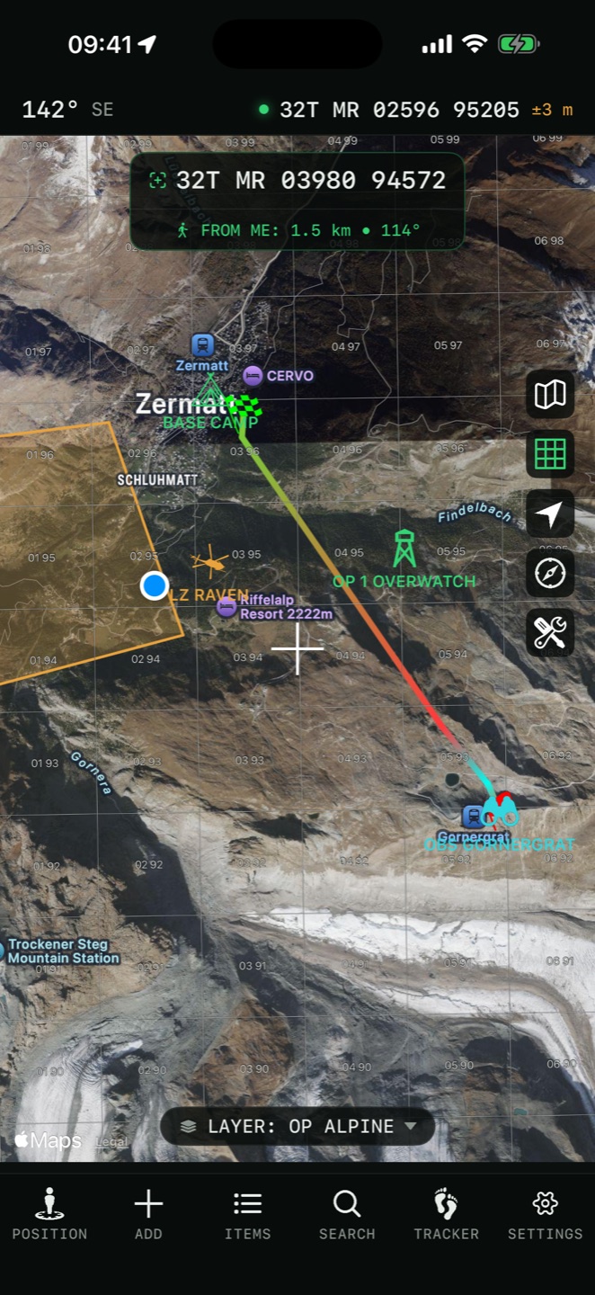
Tactical GPS is a single full-screen map. There are no buried menus: everything hangs off three surfaces — the control column on the right edge of the map, the tab bar at the bottom, and the floating tool dock that appears while terrain tools are active.
map controls
The column of buttons on the map edge, top to bottom:

Map Type
Switch between map types — street, satellite, topographic, trail and specialty layers.

Grid Toggle
Show or hide the MGRS coordinate grid overlay on the map.

Center on Location
Center the map on your current position and follow your movement.

Compass Mode
Lock map rotation and display a compass.

Recording Indicator
Blinks red while GPS tracking is active. Tap it to view the current tracking session.

Layer Pill PRO
The layer name at the bottom of the map shows the active layer. Tap it to switch between layers or manage them.
tab bar

Position
Detailed information about your current location: coordinates in every format, altitude, speed and weather.

Add
Create new items — pins, direction routes, polylines, polygons, circles or rectangles — drawn directly on the map.

Items
Browse and manage all saved pins and overlays. Search, add via form, edit via form, delete.

Search
Find locations by address or by coordinates and jump straight to them.
Tracker
Start and stop GPS tracking sessions. Review elevation profiles, speed data and session history.

Settings
Customize units, coordinate formats, map appearance and app behavior.
map interactions

Scroll the map
Moving the map places a crosshair at its center — the app continuously shows distance and bearing from your position to it. Terrain tools also run from the crosshair.

Tap a pin
Opens pin details: navigate to it, get directions, check the weather forecast there, or edit the pin.
Tap an overlay
Shows its measurements — length, area or radius — and editing options.
field tips
free vs pro
The download is free and includes core MGRS/UTM navigation. Pro unlocks the full toolkit — unlimited saved items, layers, offline map regions, full terrain analysis, directions and data import/export. Features that need Pro are marked PRO throughout this manual.